 |
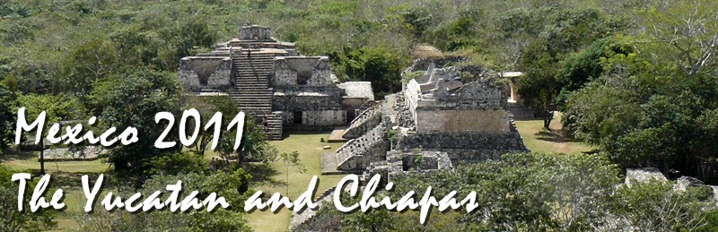
The
ruins at Ek Balam, near Valladolid, Yucatan |
Pages 1
| 2 | 3
| 4 | 5
| 6 | 7 | 8 | 9 | 10 | 11 | 12
|
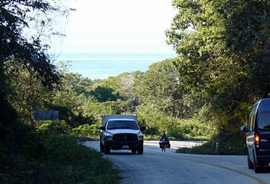
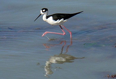
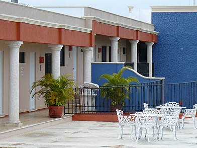
Page 7: Cycling Beyond the Guidebooks, February 7- 12 The itinerary for the next several days took us beyond the coverage of the guidebooks we've seen — and with darned little information on the internet, for that matter. We rode to Champoton, Escarcega, Candelaria — all in Campeche State — and then to Balancan and Emiliano Zapata, in Tabasco. Emiliano Zapata was the last stop before Palenque, Chiapas. On Monday, February 7, we left Campeche for Champoton. We knew from the internet that Champoton has hotels, but none of our guidebooks described the place, so we weren't sure what to expect. Much of the ride was along the gulf. Below left, the Gulf is in the background. Although the ride was 50 miles on a main highway, traffic was generally light. Below right, a dainty resident of the coast.
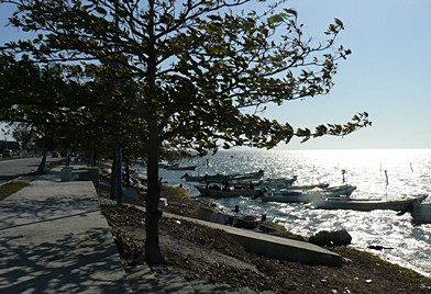
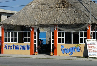
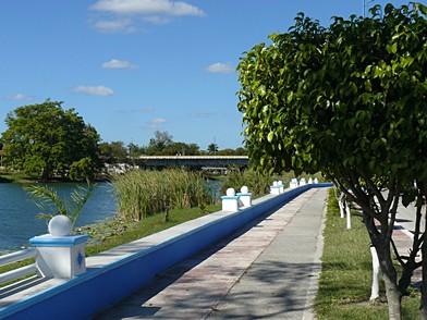
Champoton was a pleasant surprise, in some ways. It has a malecon that goes on for a few kilometers, with many benches and "cocktail" stands, meaning seafood cocktails. The hundreds of grubby little fishing boats lining the waterfront and the strong breeze off the gulf made it quite pleasant. Below left, the malecon. However, there were downsides. Seeing the gulf from a distance, light green in the sun, made us want to swim. However, up close the waterfront was generally lined with litter, and the water was brown and unappealing. So we never had our swim in the Gulf of Mexico. There is absolutely no reason to include a photo of the restaurant below, right — except its name.
On Tuesday, we moved on to Escarcega,
a little more than 50 miles south of Champoton. This was to be
the last place covered in any guidebook until we reached Palenque.
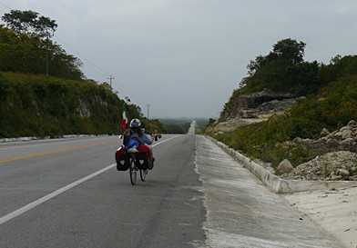
The day was cloudy, with enough drizzle that I had to put the
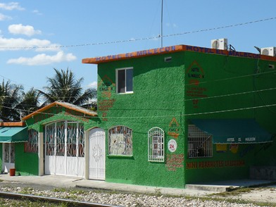
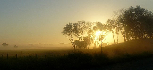
The brief mention we saw of Escarcega implied that it was no place to stay for long. Escarcega turned out to be a sprawling commercial center at a major crossroad, not appealing. We chose a hotel based largely on its murals — not because they were great, but simply because they were murals. Barbara is crazy for murals. The hotel turned out to be not bad. There was even free coffee. We took no pictures of anything in Escarcega. Since the day was grey and the town was grubby, we never took the camera out of the pannier. No doubt there were many nice people living there — and we did have some wonderful tortas — but in general it was a town you want to leave. The 42-mile ride from Escarcega to our next destination, Candelaria, was something else entirely. Beautiful! It was our best day of cycling so far on the Yucatan Peninsula. The landscape was rolling with plenty of trees and shade, quiet and generally clean roads, cool in the morning and hot but not terriby humid when we arrived at noon.
Above left, a few kilometers out of Escarcega, with the sun rising. Above right, rolling along was a pleasure. The town of Candelaria itself, while hardly a tourist mecca, was smaller, cleaner, and apparently more prosperous than Escarcega. There was even a river in Candelaria — a river! This is a huge change from Yucatan State, which is mostly hot, flat, and with virtually no surface water of any kind. Below left, the Candelaria River. Below right, the modest little Hotel Malecon that we really enjoyed. Despite the garish green exterior, our room was a lovely, pale yellow with lots of light, immacualte. The owners were very friendly and helpful. By the way, they charged about $20 U.S. for the room, with cable TV and wireless internet.
Visiting a big, modern hardware store in Candelaria, we met the niece of the owner. She spoke perfect English, not surprising because she had lived in Chicago since she was three. She explained that she recently came to Candelaria to work in the family business because she found so few employment opportunities in Chicago. She also helped us sort out our directions to the next destination. Below left, near the central squareof Candelaria. Below right, leaving Candelaria before dawn, we crossed the Candelaria River.
Our destination was Balancan, Tabasco. It was meant to be our longest ride so far, a little less than 60 miles.Below, another photo on the ride from Candelaria to Balancan, taken just after dawn.
On the ride to Balancan, we went off the route by mistake for the first time. It cost us another 15 miles, so we ended up cycling about 75 miles. More than we wanted! We arrived in Balancan sometime after 3 pm, only because we'd gotten an early start from Candelaria, and we were hot and tired.
Balancan itself was disappointingly crowded and grubby. Our hotel — the second try — was acceptable, and the room itself — which also took a second try — was quite good, but it was right on the noisy main street. When we woke Friday morning, February 11, it was raining fairly hard. The photo below was from our hotel window. You can't see the raindrops, but you can see how wet the streets are. We brewed tea, took our time packing, and hit the street around 8:30. The ride to our next stop, Emiliano Zapata, wasn't too long, just 48 kilometers, be we expected to go slowly in the rain.
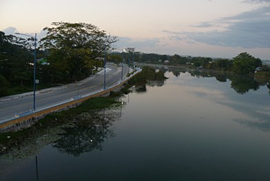
Emiliano Zapata turned out to be bigger and noisier than we'd hoped, and the three downtown hotels we saw looked dreadful. Acting on advice from a young man in the city, we headed back out of the town center. Below left, looking back to Emiliano Zapata. The city is visible on the right. The river is Rio Usamacinta, one of the biggest rivers in Mexico and Central America. It's sad that the city of Emiliano Zapata has done nothing with its waterfront. It has great potential. We stayed in the hotel below right. It was expensive for this area — 700 pesos, nearly $60 U.S. — but probably better than a decent Motel 6. We put it on the credit card. Come to think of it, this is the most that we've paid for a hotel anywhere in Mexico, even including our favorite Casa Gonzalez in a swank part of Mexico City!
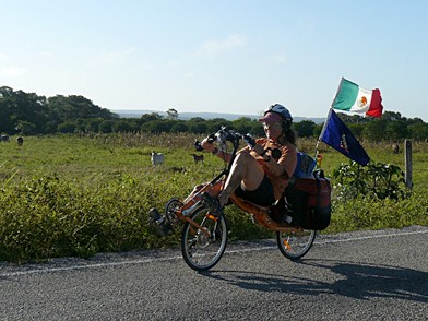
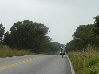
On Saturday February 12, we made
it to Palenque. The 35 mile ride wasn't long, but at least half
the time it was pouring rain, there were moderate hills, and there
was lots of traffic, including some big trucks. The only photo
I took on the ride is below right, and I took it only because
it was time to put the camera in a pannier to protect it from
the
<< Previous page Next page >>
|
 camera
in a pannier. (The only reason for the photo at left is that I
was about to put the camera away, and it gives an idea of the
road.) Somewhere along the ride, we cycled our 1,000th kilometer
so far. (About 625 miles. Cyclists will know that we are not pushing
hard.)
camera
in a pannier. (The only reason for the photo at left is that I
was about to put the camera away, and it gives an idea of the
road.) Somewhere along the ride, we cycled our 1,000th kilometer
so far. (About 625 miles. Cyclists will know that we are not pushing
hard.)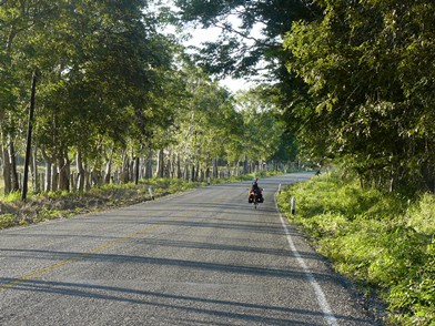
 Thinking
back about it, the day wasn't bad, just long. The first part of
the ride was on quiet roads, very much like the beautiful ride
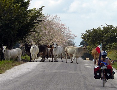
to Candelaria. Once, we nearly provoked a cattle stampede! (Right.
One of the steers was terrified by our bikes and took off in a
panic. The cowboys had to chase him down and lasso him, just like
a rodeo!) There were many ranches along the way.
Thinking
back about it, the day wasn't bad, just long. The first part of
the ride was on quiet roads, very much like the beautiful ride
to Candelaria. Once, we nearly provoked a cattle stampede! (Right.
One of the steers was terrified by our bikes and took off in a
panic. The cowboys had to chase him down and lasso him, just like
a rodeo!) There were many ranches along the way.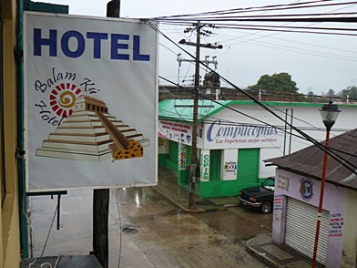 It
never ceases to surprise us when cycling in the rain turns out
to be more enjoyable, or at least more tolerable, than we anticipate
before doing it. Actually, there were two fun things along the
ride. A couple of journalists flagged us down for a photo and
a quick interview — but they were only from a local paper.
Now that we've been on television, it seems so ... ho-hum. The
other neat thing was that when we stopped along a dull stretch
of road, who should step out of a little house but a biology grad
student and his wife, from Duke University. He's here studying
manatees, which come up the river from the Gulf. They were a very
nice couple, and we had a good talk. Quite a pleasant surprise!
It
never ceases to surprise us when cycling in the rain turns out
to be more enjoyable, or at least more tolerable, than we anticipate
before doing it. Actually, there were two fun things along the
ride. A couple of journalists flagged us down for a photo and
a quick interview — but they were only from a local paper.
Now that we've been on television, it seems so ... ho-hum. The
other neat thing was that when we stopped along a dull stretch
of road, who should step out of a little house but a biology grad
student and his wife, from Duke University. He's here studying
manatees, which come up the river from the Gulf. They were a very
nice couple, and we had a good talk. Quite a pleasant surprise!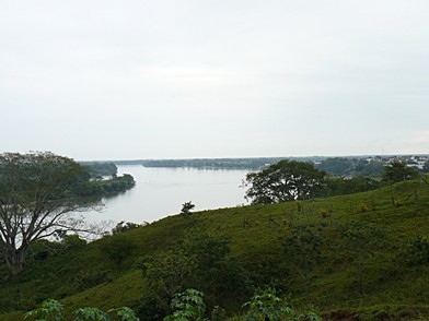
 increasing
rain.
increasing
rain.