 On the way
to the Cape of Good Hope
On the way
to the Cape of Good HopeJanuary 15
On Tuesday morning we said
goodby to John and Rita and cycled into Cape Town. It was only
something like 20 miles, but
all of it in traffic and much of it in the city, which sprawls on
forever.
Our first couple of tries at accommodation were unsuccessful, but we ended up at Riverside Lodge, an International Hostel that wasn't too bad. We wandered around a little in the Observatory area in early evening, and for supper I brought back some good sandwiches from a nearby cafe. Observatory is a funky, interracial and international area; we liked it well enough, for a city.
Below: in Cape Town's Observatory neighborhood
January 16 - 18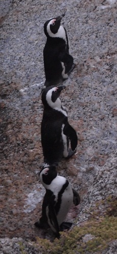
Wednesday we rode back out of the city, this time to the south, aiming for the Cape Peninsula. Even when we escaped Cape Town, we didn't like it much because the area around Muizenberg was very built-up, with houses and high rises lining the coast and a train track between the busy road and the shore.
Beyond Muizenberg, after a series of tourist towns that blur together in our minds, we reached Simon's Town, and it was much nicer, we thought. Smaller, no more train tracks – more comfortable for us. We stopped at Boulders Beach for our first swim in the South Atlantic.
There was a “holiday resort� where we'd intended to pitch our tent – but have I mentioned the wind? It was roaring, and we used that as an excuse to rent a shabby little “self-catering� rondavel-style cottage at the resort. I thought it was overpriced, but then it's location, overlooking the sea, made up for a lot of deficits. We took the place for two nights, to serve as our base for a trip out to the Cape of Good Hope.
Wednesday evening, after a dinner of take-out from the village, we walked along the rocky shore, below a protective fence that's meant to keep penguins from getting into the road. It was beautiful in the evening light, and we saw many penguins. They're such comical birds, and we were able to get quite close to a few of them. Unfortunately it was growing darker, so our photos are not good quality.
The Cape of Good Hope
The ride to the Cape of Good Hope National Park on Thursday was slightly uphill against a moderate headwind. It was quite cloudy when we started, especially at the tops of the mountains. We arrived well after noon at Visitors' Center. From there, trails led up to Cape Point, where there is a lighthouse, and out to the Cape of Good Hope. The trail to the point was fairly steep, and we didn't bother with it, but we were amazed by the number of people who paid good money for a funicular ride to the top – a walk, albeit steep, that was supposed to take only 15 minutes. Instead, we walked the one-hour round trip to the Cape of Good Hope.
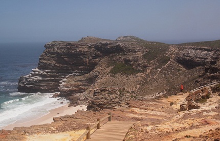 Walking to the Cape of Good Hope |
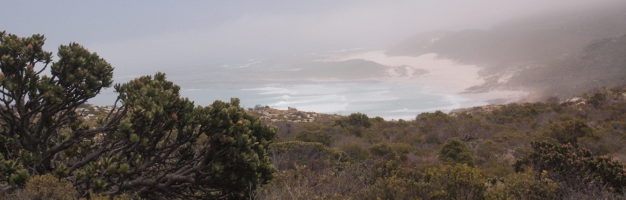
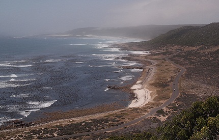 Looking from the Cape up the west coast |
Words
fail. The weather had cleared,
the sun was brilliant, and it was a wonderful experience.Besides the
great views, there was a feeling of immense
spaciousness. We stayed out at the Cape for a while, took some
pictures, and then, on the 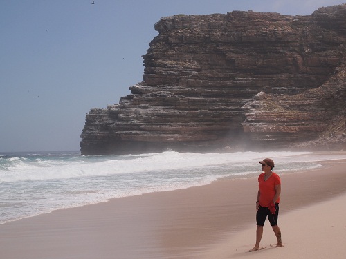 way back, walked several hundred steps
down to a gorgeous beach. Signs said it wasn't safe for swimming, and
the water was fairly cold anyway, but we waded a little just for the
symbolism.
way back, walked several hundred steps
down to a gorgeous beach. Signs said it wasn't safe for swimming, and
the water was fairly cold anyway, but we waded a little just for the
symbolism.
(By the way, the South Atlantic and the Indian Ocean do not actually meet at the Cape of Good Hope, but at Cape Agulhas, which is a bit farther east, and is really the southernmost tip of Africa.)
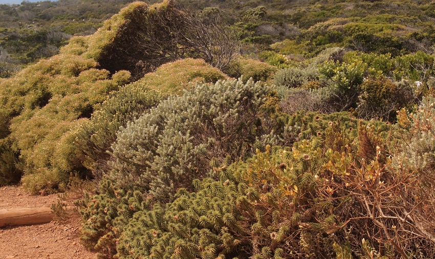
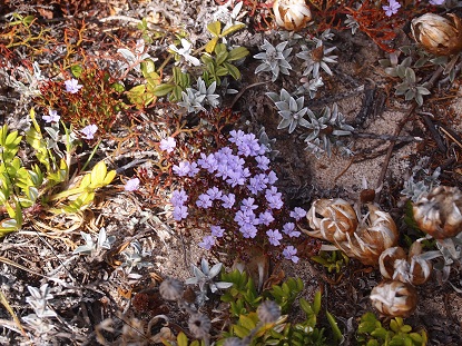
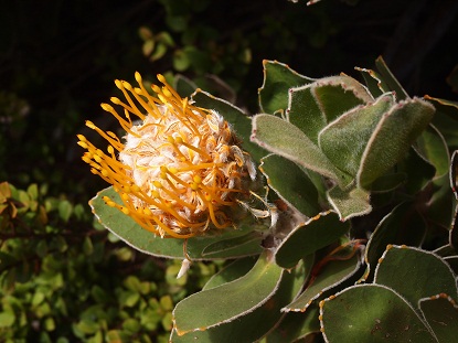
Fynbos
We are gradually coming to appreciate what's called "fynbos." This Afrikaans word means fine bush, and it's not a particular plant, but ecosystems of low-growing plants that thrive in the southern Cape. Below are examples.
 January 18
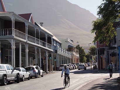
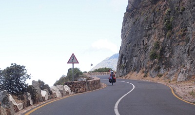
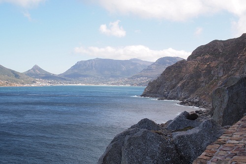
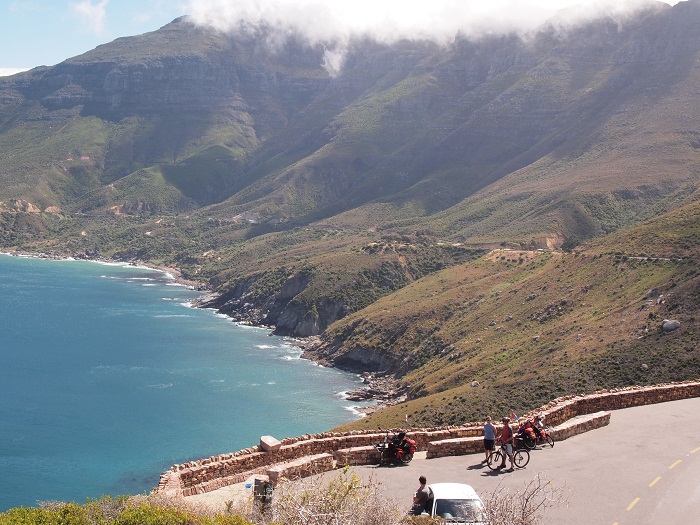
Friday morning we cycled back into Cape Town. Part of the ride was on the Chapman's Peak Drive. It's a scenic toll road (though bikes were free) and “scenic� doesn't begin to describe it. The road twists higher and higher above the sea, sometimes with only a low stone wall between you and sheer space. Spectacular views of the ocean and mountains came one after another.
Notice the stone wall in the photo to the right. Below is the view over it! Following that, there is a photo taken at a rest area on the way down.
Soon
we were back in high-end
vacationland, Camps Bay to be specific, and we planned to cycle a
steep road from there, passing the Table Mountain tram station, back
into Cape Town. But have I mentioned the wind? It roared down the
mountainsides, and combined with the steepness of the grade,
it made
the terribly difficult. We climbed for about 10 minutes, but
unfortunately 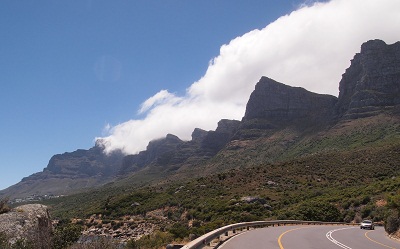 there
were no distances on the road signs, nor on our map, so we had no idea
how much longer we would have to climb. Wimps, we turned back downhill
(fun!) and continued to follow the shore. We had to ride straight
through downtown Cape Town to reach our
destination, the home of Wim and Hanlie Coatzee, in Salt River (a
district near Observatory.
there
were no distances on the road signs, nor on our map, so we had no idea
how much longer we would have to climb. Wimps, we turned back downhill
(fun!) and continued to follow the shore. We had to ride straight
through downtown Cape Town to reach our
destination, the home of Wim and Hanlie Coatzee, in Salt River (a
district near Observatory.
 Unfortunately, we have
no photos from
the time we entered the city until Wim and Hanlie's. We were too busy
finding our way in heavy traffic to think about
photography. And have I mentioned the wind? At every corner
the
wind seemed to howl from a different direction, threatening to knock us
right off our bikes!
Unfortunately, we have
no photos from
the time we entered the city until Wim and Hanlie's. We were too busy
finding our way in heavy traffic to think about
photography. And have I mentioned the wind? At every corner
the
wind seemed to howl from a different direction, threatening to knock us
right off our bikes!
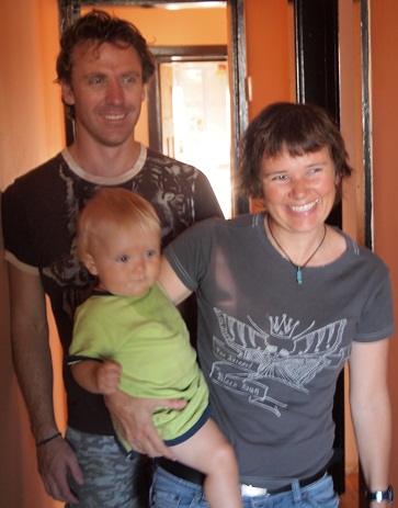
Wim and Hanlie could not have been nicer. They were a young couple, at least by our standards, with a cute little boy, nine-month old Eland. Both Wim and Hanlie are adventurers. They've lived in several countries, including Iran, and have cycled from New Orleans to the Canadian border. In the evening, Wim's brother Flores, a strapping kite-surfer, and his wife Alberta, came over for a braai, and it was a wonderful evening for us.